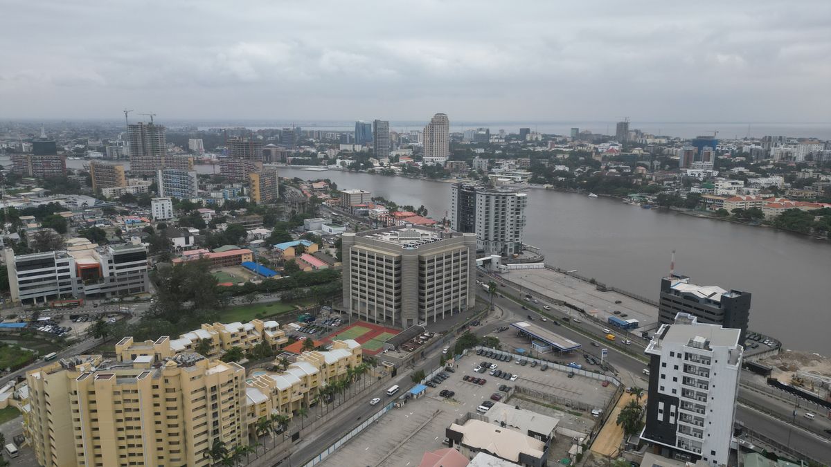
Lagos is called Lagos because Portuguese sailors named it that. In 1472 the navigator Ruy de Sequeira reached the coast and recorded the wetland area as Lago de Curamo. Lagos is the Portuguese word for lakes, and the name pointed at two things at once: the lagoon network spreading behind the barrier islands, and Lagos, the seafaring town in southern Portugal.
The place already had a name. Long before any European ship came near the Bight of Benin, the islands were settled and governed as Eko by the Awori, a Yoruba subgroup who fished the creeks and farmed the land there.
What sits on the map today carries every layer of that history. An Awori settlement became a Benin outpost, then an Atlantic trading port, then a British possession in 1861, and finally the commercial capital of Nigeria. The fact that both names survived, Lagos on paper and Eko in speech, is the clearest record of how much changed and how much did not.
What the Portuguese name actually meant
Lagos is the plural of lago, lake. The Portuguese chose it because of what the coastline looked like from the water: the Lagos Lagoon, the creeks running inland, the barrier islands, and the wetlands that separate the mainland from the Atlantic.
De Sequeira arrived during the Age of Discovery, when Portuguese navigators were mapping the West African coast to open trading routes and find safe anchorages along the Atlantic corridor. The settlement he encountered went into the record under a European name.
Historians trace that name to Lagos in the Algarve, a maritime town in southern Portugal that served as a launch base for expeditions under Prince Henry the Navigator. The choice was a nod to home, not a description of the people living on the islands.
Once the name entered Portuguese nautical charts and commercial logs, it stuck. European sailors depended on those charts to get past the coastal bars and sand spits guarding the entrance to the sheltered water of the Bight of Benin, and every copy of the chart carried the name forward.
Over the next two centuries merchants clipped Lago de Curamo down to Lagos. By the time imperial maps and treaties were being drawn, the short form was the only one anyone used.
The Awori settlement and the Benin era
The founding story runs through the Ogun River. The Awori first settled at Isheri under Ogunfunminire, then moved downstream toward Iddo Island and Lagos Island.
They called the place Oko, an Awori word for a farm or plantation settlement. Across regional Yoruba dialects the pronunciation shifted, and Oko became Eko.
By the late sixteenth century, during the expansion of the Benin Empire under the Oba of Benin, the farming island had become a fortified military camp. Benin military expeditions turned it into an administrative garrison and brought royal court traditions, a military hierarchy, and hereditary titles that are still in use.
You can see that inheritance in the traditional leadership today. The office of the Oba of Lagos and the Idejo class of white cap chiefs both trace their lineage back to that early Awori and Benin arrangement.
Eko is still the indigenous name of the territory, and it marks the difference between native institutions and the label the colonial administration used. It carries the pre-colonial sovereignty of the people who were already there, along with the ancestral shrines, the communal landholding customs, and the festival rituals.
| Period |
Name in use |
Governing authority |
Landmark event or feature |
| Pre-15th century |
Oko / Eko |
Awori subgroup, Olofin lineage |
Settlement established at Iddo and Lagos Island |
| 1472 onward |
Lago de Curamo / Lagos |
Portuguese explorers (Ruy de Sequeira) |
Mapping of Lagos Lagoon and the Atlantic waterways |
| 16th to 19th century |
Eko / Lagos |
Kingdom of Benin influence, Oba of Lagos |
Fortified commercial hub and Atlantic trade port |
| 1861 to 1960 |
Lagos Colony and Protectorate |
British colonial administration |
Treaty of Cession, 1861; national capital |
| 27 May 1967 |
Lagos State |
Federal Military Government (Decree No. 14) |
State created with five divisions |
| 1991 to date |
Lagos / Eko |
Lagos State Government |
Federal capital moved to Abuja; commercial lead retained |
Trade, the Atlantic, and the 1861 cession
Geography did most of the work. Sitting at the southwestern mouth of the lagoon, with sand spits sheltering the water behind them, the settlement had natural harbours, and that made it a hub for regional and transcontinental commerce.
Through the eighteenth and early nineteenth centuries the port was deeply tied to the transatlantic slave trade. The commercial pattern echoed the slave markets that had operated out of Lagos in the Algarve.
European slave merchants set up coastal factories on the barrier islands and traded manufactured goods, firearms, and spirits for captives brought down the lagoon systems from the Yoruba hinterland.
British forces then began intervening in local succession disputes. That led to the naval bombardment of Lagos in 1851, carried out under the stated aim of shutting down maritime slave exports and putting Oba Akitoye back on the throne.
Ten years later, on 6 August 1861, Oba Dosunmu signed the Lagos Treaty of Cession under British naval pressure. The island and its port passed to the British Crown, and the Lagos Colony was established.
From then on, Lagos was the only administrative name the territory had in imperial statutes, gazettes, court records, and international treaties.
Colonial administration also brought heavy construction. Deep water berths went up at Apapa, railway lines pushed into the interior, and permanent roads linked the island to the mainland.
Capital city, then state: Decree 14 and after
After independence in 1960 Lagos held two roles at once. It was the capital of the Federal Republic of Nigeria and the seat of federal executive power.
On 27 May 1967 the Federal Military Government issued Decree No. 14, which created Lagos State as a federating unit made up of the old city together with the Badagry, Epe, Ikorodu, and Ikeja divisions.
That single move pulled a spread of coastal and inland communities under one sub-national government, and it widened what the word Lagos referred to.
The federal government seat moved to Abuja on 12 December 1991, under General Ibrahim Babangida.
Losing the political capital did not cost the city its commercial position. It went on to host Nigeria’s main sea terminals at Apapa and Tin Can Island along with the country’s major financial headquarters.
The metropolitan area is now the industrial engine of West Africa and a large source of Nigeria’s non-oil gross domestic product, still working off the same maritime geography that drew the Portuguese in the first place.
Why both names are still in use
Lagos and Eko are not competing. They sit in different places.
Legal deeds, corporate registrations, statutory certificates, and international maritime documents all use Lagos, the Portuguese name.
State cultural institutions, traditional ceremonies, everyday speech, and the royal court of the Oba of Lagos use Eko. That is where historical legitimacy and civic pride are asserted.
Traditional songs, market talk, and indigenous theatre celebrate Eko Akete, which keeps the Awori and Benin settlers in the frame.
So the answer to why Lagos is called Lagos has two halves. European navigators applied a descriptive geographical term to a place that was already a working, sovereign society with its own name for itself.
The city has held on to both since. Lagos is what the world files it under. Eko is what it calls itself.